




The open {geojson} library
- 256+ sources, mostly Texas
- CC0 — public domain, no attribution required
- Downloadable, no account required
Try
- Datasets
- 4,911
- Features
- 1.66M
- Tile sets
- 272
- Documents
- 5,201
Recently added
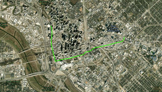
WC_HPB_Trails (HARC)
WC_HPB_Trails, published by HARC on its ArcGIS Online account. 1,132 features. Field names and coding are the publisher's own and are not standardised against other sources.
harcresearch.maps.arcgis.comTCEQ_Water_Districts (HARC)
TCEQ_Water_Districts, published by HARC on its ArcGIS Online account. 2,125 features. Field names and coding are the publisher's own and are not standardised against other sources.
harcresearch.maps.arcgis.comPUCT_Water_CCN_Service_Areas (HARC)
PUCT_Water_CCN_Service_Areas, published by HARC on its ArcGIS Online account. 3,812 features. Field names and coding are the publisher's own and are not standardised against other sources.
harcresearch.maps.arcgis.comTCEQ_Segments_2022 (HARC)
TCEQ_Segments_2022, published by HARC on its ArcGIS Online account. 1,229 features. Field names and coding are the publisher's own and are not standardised against other sources.
harcresearch.maps.arcgis.comISD_POP (Tarrant County)
ISD_POP, published by Tarrant County on its ArcGIS Online account. 22 features. Field names and coding are the publisher's own and are not standardised against other sources.
tarrantcounty.maps.arcgis.comISD Viewer_WFL1 (Tarrant County)
ISD Viewer_WFL1, published by Tarrant County on its ArcGIS Online account. 55 features. Field names and coding are the publisher's own and are not standardised against other sources.
tarrantcounty.maps.arcgis.comCity Boundaries (Tarrant County)
City Boundaries, published by Tarrant County on its ArcGIS Online account. 89 features. Field names and coding are the publisher's own and are not standardised against other sources.
tarrantcounty.maps.arcgis.comCity Limit Mask (City of San Marcos)
City Limit Mask, published by City of San Marcos on its ArcGIS Online account. 1 features. Field names and coding are the publisher's own and are not standardised against other sources.
cosm.maps.arcgis.comTrail Bathrooms (City of San Marcos)
Trail Bathrooms, published by City of San Marcos on its ArcGIS Online account. 4 features. Field names and coding are the publisher's own and are not standardised against other sources.
cosm.maps.arcgis.comFieldViewable_StormDataOnline (City of San Marcos)
FieldViewable_StormDataOnline, published by City of San Marcos on its ArcGIS Online account. 560 features. Field names and coding are the publisher's own and are not standardised against other sources.
cosm.maps.arcgis.comRoadClosures_public2 (City of San Marcos)
RoadClosures_public2, published by City of San Marcos on its ArcGIS Online account. 64 features. Field names and coding are the publisher's own and are not standardised against other sources.
cosm.maps.arcgis.comTraffic Counts 2016-2025 by Location (City of Round Rock)
Traffic Counts 2016-2025 by Location, published by City of Round Rock on its ArcGIS Online account. 145 features. Field names and coding are the publisher's own and are not standardised against other sources.
corr.maps.arcgis.comRound Rock Water Customers (City of Round Rock)
Round Rock Water Customers, published by City of Round Rock on its ArcGIS Online account. 11 features. Field names and coding are the publisher's own and are not standardised against other sources.
corr.maps.arcgis.comWilliamson County Line (City of Round Rock)
Williamson County Line, published by City of Round Rock on its ArcGIS Online account. 1 features. Field names and coding are the publisher's own and are not standardised against other sources.
corr.maps.arcgis.comSurvey Control Points and Benchmarks (City of Round Rock)
Survey Control Points and Benchmarks, published by City of Round Rock on its ArcGIS Online account. 439 features. Field names and coding are the publisher's own and are not standardised against other sources.
corr.maps.arcgis.comBOUNDARIES_city_of_austin_parks (City of Austin)
BOUNDARIES_city_of_austin_parks, published by City of Austin on its ArcGIS Online account. 371 features. Field names and coding are the publisher's own and are not standardised against other sources.
austin.maps.arcgis.comFlashing Beacons (City of Austin)
Flashing Beacons, published by City of Austin on its ArcGIS Online account. 208 features. Field names and coding are the publisher's own and are not standardised against other sources.
austin.maps.arcgis.comCity of Austin Traffic Cameras (City of Austin)
City of Austin Traffic Cameras, published by City of Austin on its ArcGIS Online account. 1,005 features. Field names and coding are the publisher's own and are not standardised against other sources.
austin.maps.arcgis.compard_trails (City of Austin)
pard_trails, published by City of Austin on its ArcGIS Online account. 4,096 features. Field names and coding are the publisher's own and are not standardised against other sources.
austin.maps.arcgis.comTraffic Signals and Pedestrian Signals (City of Austin)
Traffic Signals and Pedestrian Signals, published by City of Austin on its ArcGIS Online account. 1,345 features. Field names and coding are the publisher's own and are not standardised against other sources.
austin.maps.arcgis.comBOUNDARIES_jurisdictions (City of Austin)
BOUNDARIES_jurisdictions, published by City of Austin on its ArcGIS Online account. 389 features. Field names and coding are the publisher's own and are not standardised against other sources.
austin.maps.arcgis.comSchools 2024-2025 (Texas Commission on Environmental Quality)
Schools 2024-2025, published by Texas Commission on Environmental Quality on its ArcGIS Online account. 9,453 features. Field names and coding are the publisher's own and are not standardised against other sources.
tceq.maps.arcgis.comThe data is already public. That's not the same as available.
Texas governments publish an enormous amount of geographic information. They publish it on their own terms, in their own formats, at their own URLs, with no index and no obligation to keep it there. Finding it is a research project. Using it is a second one.
The 4,911 datasets here were gathered from 256 separate publishers — county appraisal districts, city GIS portals, state agencies, federal surveys — and rebuilt into one shape, with the source kept attached to every one.
Preview
Every dataset renders before you download it. You should be able to tell whether it's what you want without unzipping anything.
Check the source
Each one carries where it came from, when it was retrieved, and what's known to be wrong with it. Fields on the data, not a metadata page.
Take it
GeoJSON, Shapefile, Excel, CSV, KML. One click, no account, no rate limit. Everything we derive is released CC0 — no attribution required.